Precise Crop Nutrition

"Providing independent precision farming and general fertiliser advice"


Precise N-Maps

The complete nitrogen management service using satellite imagery to provide accurate nitrogen treatment plans and mapping to supplement advice on rates and timing of applications. Unique in the UK,Precise N-Maps uses raw satellite data processed by our own experts and thus avoiding the problems associated with cloud inclusion present in other services.Conversion of the data to variable N plans is based on the use of a our own decision support system and dedicated software.


Key Steps In N - MAPS process

  • Advice given on rate and timing of nitrogen applications
  • Satellite images collected
  • Appropriate N strategy decided
  • N treatment plans calculated
  • All recommendations amended to suit the grower’s preference

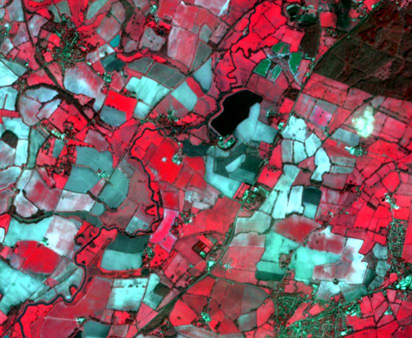
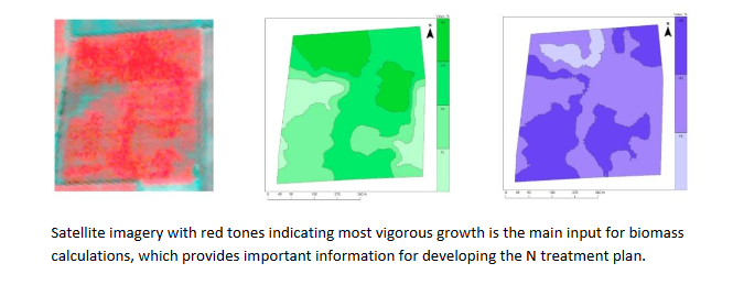
The N-MAPS service is based on the collection of digital images in the Infra red and visible ranges of the spectrum showing the whole field, obtained by satellite, which pick out the variability of crop growth. Conversion to variable nitrogen application maps is based on the application of a well proven and unique decision support system through the use of dedicated 
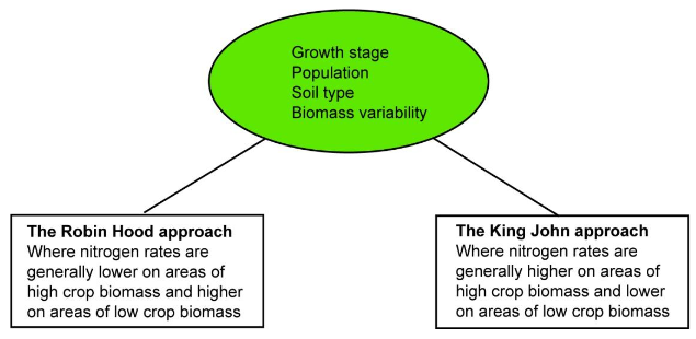
software . Part of this process is the incorporation of data such as soil mineral nitrogen levels, plant measurements, and the farmer’s yield and quality aspirations. Recommendations cover not only rates and timing of N and choice of N strategy but also which of the applications to apply variably ( one, two, or all three)

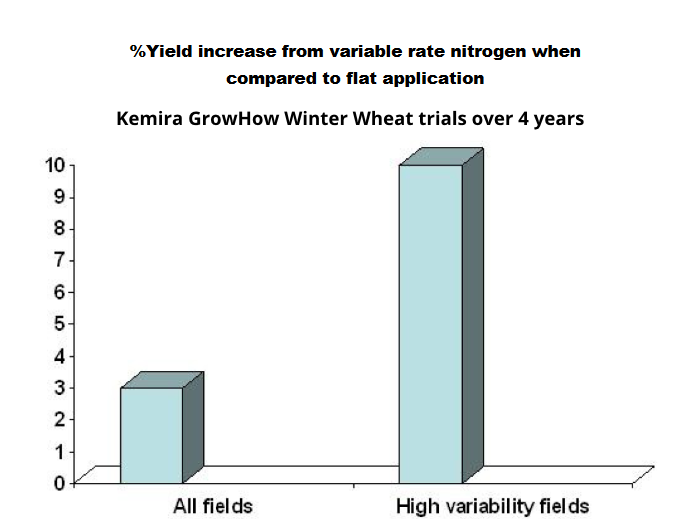
Favourable outcomes have been achieved using the N-Maps service:

  • Obtaining the best cereal and oilseed rape yields, field by field
  • Using nitrogen to its full potential, by placing it where it is needed and not wasted
  • Enhancing grain quality
  • Achieving a favourable environmental impact – improving the nitrogen footprint
  • Providing a traceable record of the application

The Benefits

  • High variability fields (Biomass coefficient of variation > 20%) gave average yield increase of 10%

  • Some fields gave 18 %

  • Some fields showed gains in grain quality

  • Reduction in lodging risk

Independent data

  • Research reported in the International Journal of Remote Sensing concerning measurement of nitrogen status of wheat from satellite data indicates processed imagery is well correlated with Nitrogen uptake in the crop and yield variables at harvest including total biomass and grain N.

  • HGCA funded research indicates a benefit of £22/ha achieved over uniform application.